|

Home
Roadklahoma Links:
Home
Terminus Page
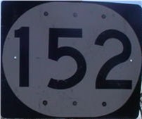
OK 152 Page
Intersecting Highways:
Interstate 40
Interstate 44
U.S. 81
U.S. 183
U.S. 281
U.S. 283
OK 4 (W)
OK 6
OK 8
OK 30
OK 34
OK 37 (N)
OK 42
OK 44
OK 54 (N)
OK 58 (S)
OK 92 (N)
OK 115
OK 146
Latest Updates
Interstate
Highways
U.S. Highways
State Highway
Terminus Gallery
E-mail OKHighways.com
(Spam filter in effect: Use @ in place of #) |
|
OKHighways.com
Terminus Gallery |
| |
|
 |
Highway History:
OK 152 was once signed as OK 41. Sometime between 1953 and 1959, the highway
was changed to OK 152 to coincide with the highway's number in Texas,
TX 152.
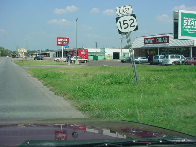
Until mid-April 2004, OK 152 ran along S.W. 74th
St. to Council Rd., then went north on Council Rd. to Newcastle Rd., then went
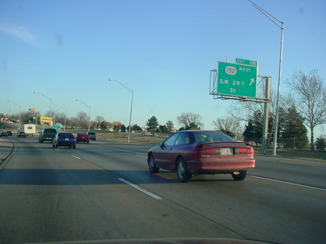
northeast on Newcastle Rd. to S.W. 29th St. The highway ended at the Interstate
44 junction. OK 152 is now signed along Airport Rd., a 4-lane freeway in
southwest Oklahoma City, and S.W. 44th St., and the eastern terminus is now at
Interstate 44 and Airport Rd., 1 1/2 miles south of the old eastern terminus.
Highway Review:
OK 152, the longest 3-digit state highway in Oklahoma, is an
east-west highway running through the western half of the state.
In western Oklahoma, the highway is known as the "Scenic
Route of Western Oklahoma." Also, there are at least eight
occasions where U.S. 152 is signed instead of OK 152!
The highway itself begins in the Texas panhandle as TX 152 east
of Pampa. Five miles after crossing the state line into Oklahoma,
you enter the town of Sweetwater, where it intersects OK 30. It
then intersects with OK 6 and OK 152 heads towards the southeast.
It goes through Sayre, the county seat of Beckham County, and
intersects U.S. 283 and Interstate 40. The highway doesn't see
another town until Cordell, 36 miles east of Sayre. OK 152 then
goes another 36 miles before its next town, Binger, where it
joins U.S. 281 and OK 8 for five miles. Nine miles east of the
U.S. 281 and OK 152 split is the town of Cogar and the
beginning of an 11-mile trek with OK 37. OK 37 and OK 152 then
split at U.S. 81, as OK 152 heads to the north, crosses the South
Canadian River, then heads east again in Union City. Then OK 152
heads its way into the Oklahoma City metro area when it enters
the suburb of Mustang (pop. 13,156). The highway is the main
route through the sprawling community and is 4 lanes with an
extra left turn lane included throughout.
After leaving Mustang, the highway heads to the
northeast on a brand new alignment to Council Rd., which means that the turns
between S.W. 74th St. and Council Rd. to stay on OK 152 are no longer necessary.
The new OK 152 between County Line Rd. and Council Rd. has a 55 mph speed limit
and is five lanes wide with a center left turn lane and a stoplight at S.W. 74th
St. A half-diamond interchange will eventually be in place at Council Rd., and
signs are up on OK 152 East for a Council Rd. exit, but for now, the new OK 152
alignment ends at Council Rd. just north of S.W. 59th St. Grading has begun near
Airport Road's current western terminus near MacArthur Blvd. to connect Airport
Rd. to this new OK 152 alignment. Until then, OK 152 goes north on Council Rd.
to S.W. 44th St., and goes east on S.W. 44th St. and Airport Rd. to Interstate
44, where OK 152 comes to an end. (For more on the OK 152 realignment, see the
OK 152 Realignment page)
Highway Information:
Distance: 149.6 miles
Counties traveled through: Roger Mills, Beckham, Washita, Caddo,
Grady, Canadian, Oklahoma
Highway intersections: OK 30 (Mile 5.1), OK 6 (Mile 9.1), U.S.
283 (Mile 25.5), Interstate 40 (Mile 26.6), OK 34 (Mile 33.1), OK
6 (Mile 39.0), OK 44 (Mile 52.0), OK 42 (Mile 54.0), U.S. 183
(Mile 62.3), OK 54 (Mile 69.9), OK 54 (Mile 76.9), OK 115 (Mile
77.9), OK 58 (Mile 84.0), OK 58 (Mile 85.8), OK 146 (Mile 94.8),
U.S. 281/OK 8 (Mile 99.1), U.S. 281/OK 8 (Mile 103.8), OK 37
(Mile 112.6), U.S. 81/OK 37 (Mile 123.4), U.S. 81 (Mile 127.6),
OK 92 (Mile 137.6), OK 4 (Mile 139.6), OK 4 (Mile 140.6),
Interstate 44 (Mile 149.6)
Highway duplexes: OK 54 (Miles 69.9-76.9, 7.0 miles), OK 58
(Miles 84.0-85.8, 1.8 miles), U.S. 281/OK 8 (Miles 99.1-103.8,
4.7 miles), OK 37 (Miles 112.6-123.4, 10.8 miles), U.S. 81 (Miles
123.4-127.6, 4.2 miles), OK 4 (Miles 139.6-140.6, 1.0 mile)
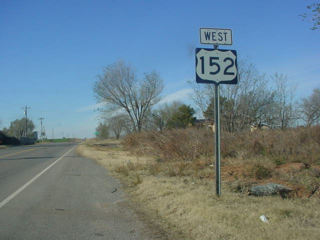
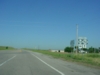
WESTERN
TERMINUS
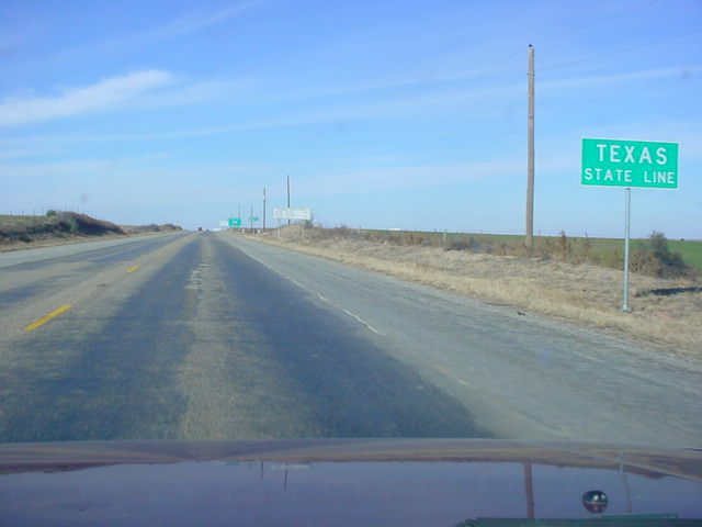
Texas State Line,
continues as TX-152
 |
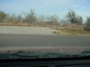
Texas State Line
sign at the point where OK 152 West becomes
TX 152.
Like most state highway termini at state lines, there is
no
"END" sign
at this terminus. (Photo taken 11/26/02) |
 |
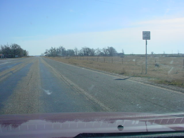
The final
TX 152 (East) shield just west of the state line. This
could be
considered the END TX 152 sign, since this is the eastern
end of
this state highway. Of course, Texas rarely signs its highway
ends, so there is no "END" tab to be seen here, or almost anywhere
else in the Lone Star State. (Photo taken 11/26/02) |
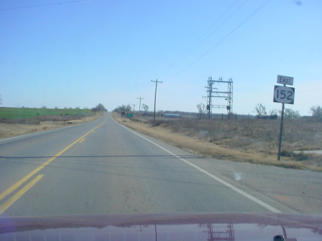
 |
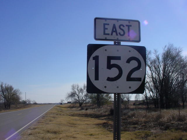
OK 152
East assurance shield just east of the state line. The
intersection
with OK 30 is in just five miles. (Photo taken
11/26/02) |
OTHER
HIGHWAY PICTURES
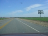
 |
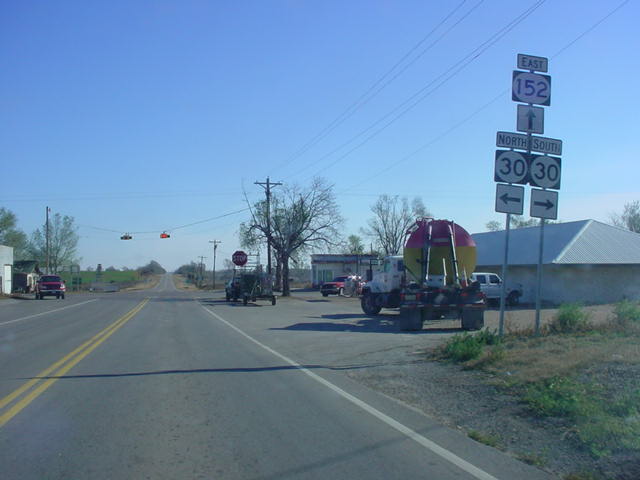
OK 152 East at OK
30 in Sweetwater. (Photo taken 11/26/02) |
 |
I didn't know that
U.S. 152 existed in Oklahoma! This is just one of
at least eight places where U.S. 152 is signed instead of
OK 152.
This particular sign is just west of OK 30. (Photo
taken 11/26/02) |
 |
ODOT got the sign
right on the eastbound lanes, however! But as
you'll see, they mess up quite a few more times! (Photo
taken
11/26/02) |
 |
OK 152 East at OK
6. Here we go again with U.S. 152 being
signed here instead of OK 152! (Photo taken 11/26/02) |
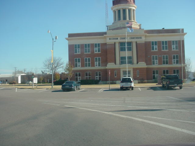
 |
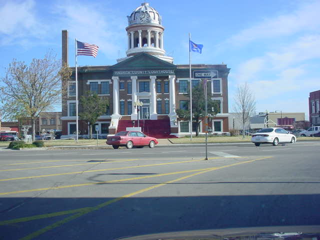
A view of the
Beckham County Courthouse in Sayre from OK 152
East. This is one of two times that OK 152 heads around a
county courthouse. (Photo taken 11/26/02) |
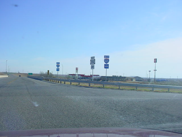
 |
OK 152 East at
Interstate 40 West in Sayre. (Photo taken 11/26/02) |
 |
OK 152 East shield
just east of Interstate 40. (Photo taken
11/26/02) |
 |
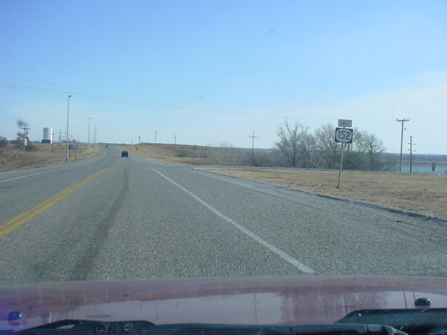
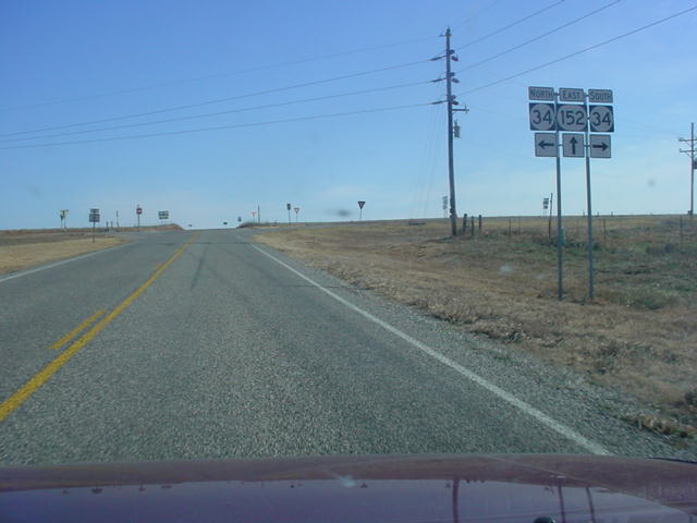
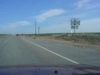
OK 152 East at OK
34 south of Elk City. U.S. 152 is signed at least
twice in the approaches of this intersection. (Photo
taken 11/26/02) |
 |
OK 152 East just
east of OK 44 near Dill City. (Photo taken
11/26/02) |
 |
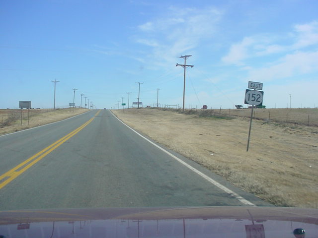
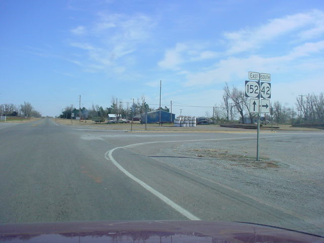
OK 152 East at OK
42 South in Dill City. OK 42 is basically a way
to get to the "business district" of this small
town. The highway ends
about a mile south of this intersection. (Photo taken
11/26/02) |
 |
Well, we're back on
U.S. 152 again! This shield is located just east
of OK 42. (Photo taken 11/26/02) |
 |
The second of two
county courthouses OK 152 sees in western
Oklahoma, this one is the Washita County courthouse in
Cordell.
(Photo taken 11/26/02) |
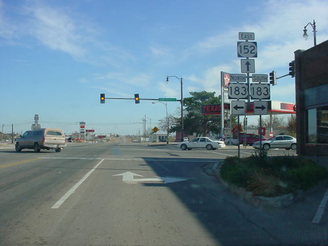
 |
OK 152 East at U.S.
183 in Cordell. U.S. 183 enters Clinton 15
miles north of this stoplight. (Photo taken 11/26/02) |
 |
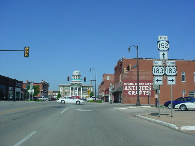
OK
152 West at U.S. 183 in Cordell. The
Washita County
courthouse is straight ahead. (Photo taken 5/6/04) |
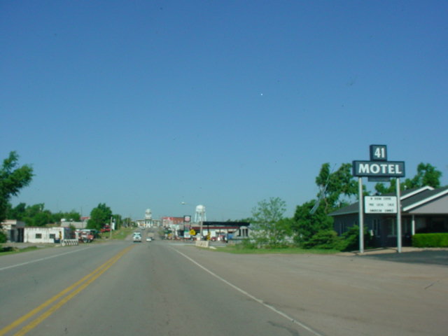
 |
This motel in Cordell bears the name "41 Motel," after the
highway that this road was originally. OK 41 was renumbered OK
152 in the 1950s, so this motel's name is the only remaining
sign of the highway's original number. (Photo taken 5/6/04) |
 |
OK
152 West/OK 54 South at OK 54 South.
(Photo taken
5/6/04) |
 |
OK 54 North/OK 152
East just east of OK 54. The two highways
are duplexed for seven miles. (Photo taken 11/26/02) |
 |
The departure of OK
54 North from OK 152 East takes place at this
point. (Photo taken 11/26/02) |
 |
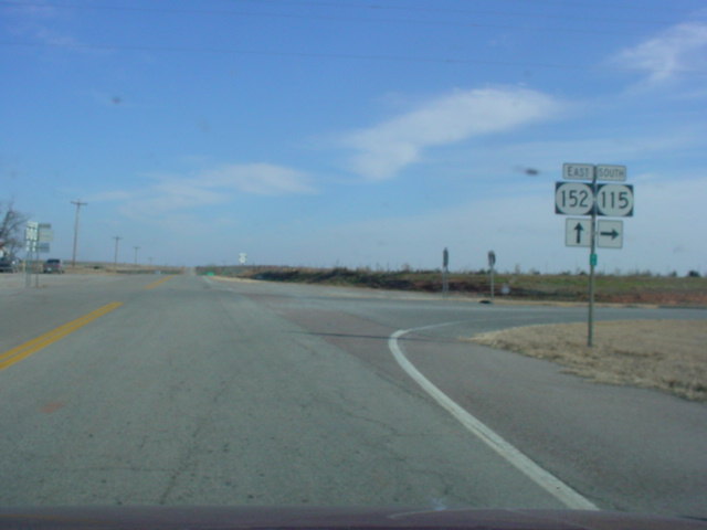
OK 152
East at OK 115. This is the
northern terminus of OK 115,
which runs from here down to
Cache
at U.S. 62. (Photo taken
11/26/02) |
 |
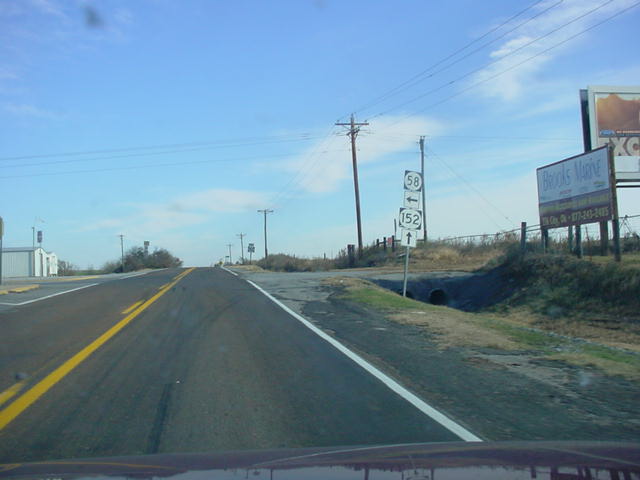
OK 152 East at OK
58 between Cordell and Binger. (Photo taken
11/26/02) |
 |
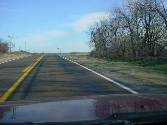
OK 152 East/OK 58
North shields just east of OK 58. OK 58 joins
OK 152 for 1.8 miles. (Photo taken 11/26/02) |
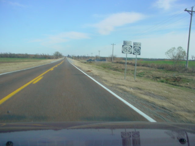
 |
OK 152
East/OK 58 North at OK 58 North. (Photo
taken 11/26/02) |
 |
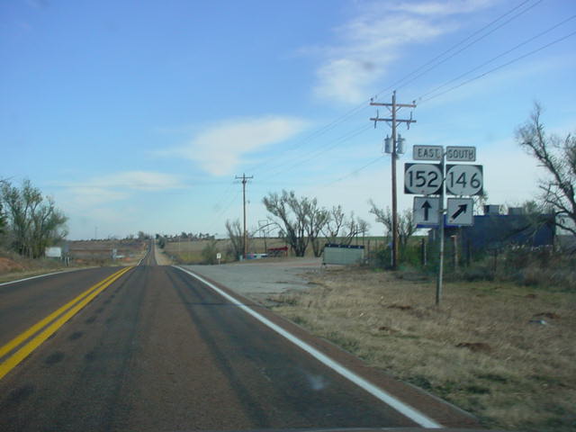
This intersection
could be a candidate for the two highest numbered
state highways to intersect in Oklahoma. This is OK 152
East at OK
146 South west of Binger. OK 146's northern terminus is
located
here. (Photo taken 11/26/02) |
 |
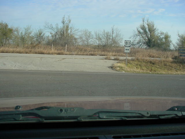
U.S. 281/OK 8
North/OK 152 West assurance shields
just west
of U.S. 281/OK 8
South east of Binger. (Photo taken 11/26/02) |
 |
U.S. 281/OK 8 North/OK 152
West at U.S. 281/OK 8 North in
Binger. The
advance signage for this intersection from southbound
U.S. 281/ OK
8 indicates that this is once again U.S. 152. (Photo
taken 11/26/02) |
 |
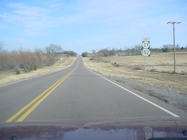
OK 37/OK 152
East assurance shields just east of OK 37 near
Cogar. The two
highways are joined for 10.8 miles from here to
U.S. 81. (Photo
taken 11/26/02) |
 |
OK 37/OK 152
East at
U.S. 81 just north of Minco. OK 37 heads
south
(to the right), while OK 152 heads north (to the left). (Photo
taken
11/26/02) |
 |
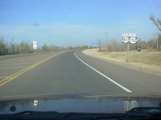
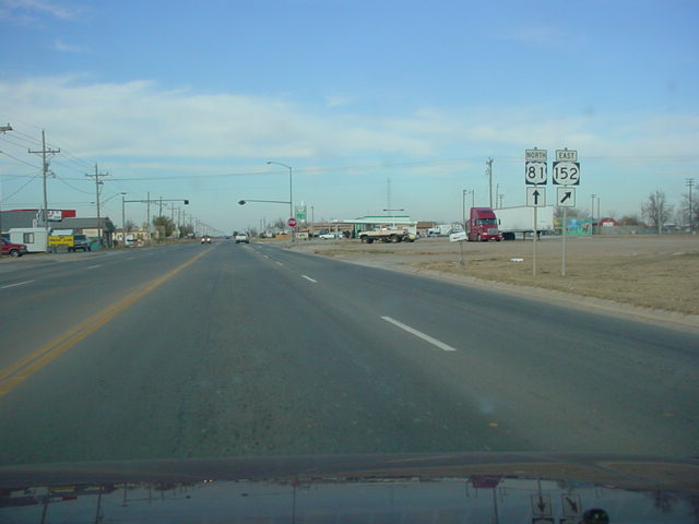
U.S. 81 North/OK
152 East shields just north of OK 37/152. The two
highways cross the South Canadian River before splitting
at a 4-way
stop in Union City. (Photo taken 11/26/02) |
 |
U.S. 81 North/OK
152 East at the place of OK 152's departure in
Union City. From here, the highway heads towards Mustang
and
Oklahoma City. (Photo taken 11/26/02) |
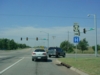 |
OK 152
West at OK 92 in far west Mustang.
(Photo taken 9/21/04) |
 |
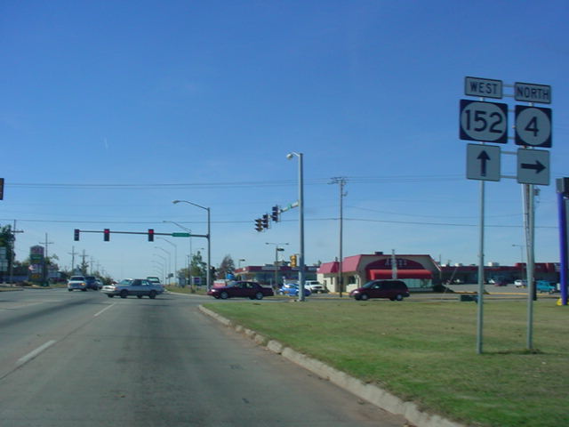
OK 152 West/OK 4
North at OK 4 North in Mustang. OK 4 continues
north from this stoplight and intersects Interstate 40,
OK 66, and OK
3 as it heads through Yukon and Piedmont, where it finds
its
northern terminus. (Photo taken 11/13/02) |
 |
Another view of the
same intersection two months later. Turn left at
the stoplight and you can get to Mustang High School,
home of the
Bronchos. (Photo taken 1/31/03) |
 |
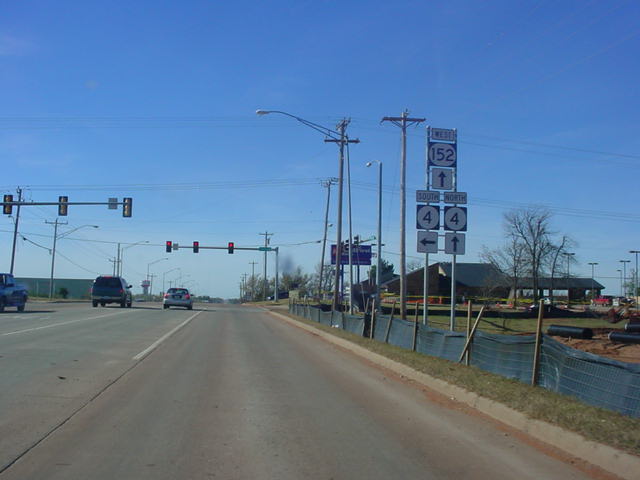
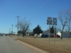
OK 4
South/OK 152 East at OK 4 in
Mustang. (Photo taken
8/24/02) |
 |
OK 152 West at OK 4
South in Mustang. The construction to the
right is for a new Wal-Mart Supercenter which was being built to
replace the
old, outdated one at the OK 4 North/OK 152
intersection. The bottom photo shows the same intersection two
years later, with all sorts of commercial development in the area.
(Top photo
taken 11/13/02, bottom photo taken 9/21/04) |
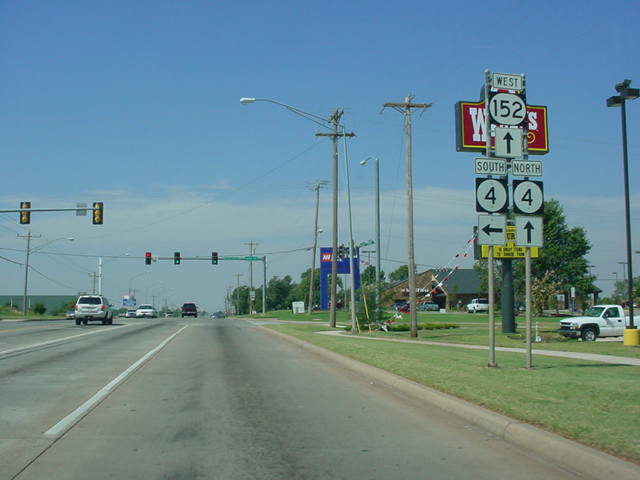
 |
OK 152 West/OK 4
North shields just west of the OK 4 South
intersection in Mustang. OK 4 will depart on its own a
mile later.
(Photo taken 1/31/03) |
NEW ALIGNMENT
(See OK 152 Realignment page
for pictures and a map) |
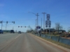
 |
OK 152
East as Airport Rd. is about to
begin. The highway
divides just past the
curve. (Photo taken 2/13/04) |
 |
OK 152
West at the current
western end of Airport Rd. The
freeway will eventually continue two miles to the west to connect
with the recently constructed OK 152 at Council Rd. (Photo
taken 2/13/04) |
 |
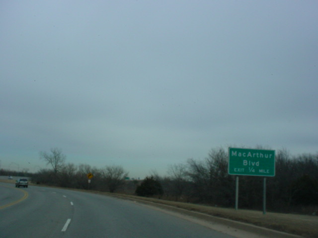
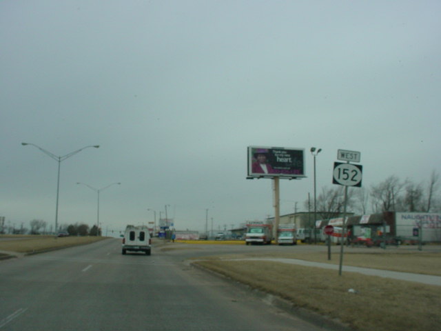
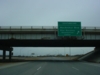
OK 152
East approaching MacArthur
Blvd. - 1/4 mile. No sign is
in place for
Southbound MacArthur. (Photo taken 2/13/04) |
 |
OK 152
West at MacArthur Blvd.
Southbound - Mike Monroney
Aeronautical
Center. (Photo taken 2/13/04) |
 |
OK 152
East at MacArthur Blvd.
Northbound. (Photo taken 2/13/04) |
 |
OK 152
West at MacArthur Blvd.
Northbound. The gantry pictured
only has
a sign for MacArthur southbound, but this
is where the
northbound off-ramp departs. (Photo taken 2/13/04) |
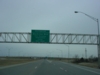
 |
OK 152
East at Meridian Ave.
Southbound/Airport. Will Rogers
World
Airport is one mile to the south. (Photo taken 2/13/04) |
 |
OK 152
West at Meridian Ave.
Southbound/Airport. (Photo
taken 2/13/04) |
 |
OK 152
East at Meridian Ave.
Northbound. Interstate 44 is one mile
ahead. (Photo taken 2/13/04) |
 |
OK 152
West at Meridian Ave.
Northbound. (Photo taken 2/13/04) |
EASTERN
TERMINUS
Airport Rd. @ Interstate 44, Oklahoma City
 |
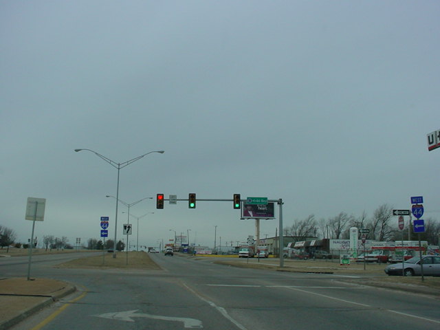
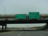
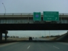
OK
152 East approaching Interstate 44 - 1/2 mile. (Photo
taken
2/13/04) |
 |
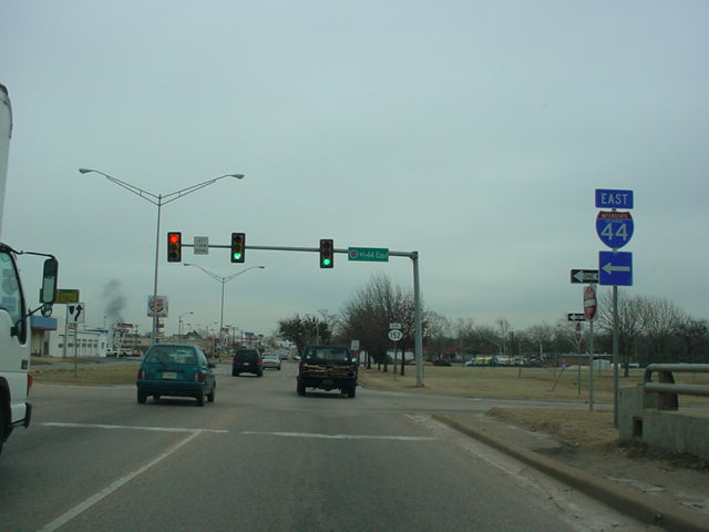
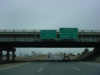
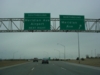
OK
152 East at Interstate 44. There is no "END" sign at this
terminus, but then again, this had been the eastern terminus
for only a couple days when I was last in the area on 4/19/04,
and when this picture was taken, OK 152 was still signed along
S.W. 29th St. (Photo taken 2/13/04) |
 |
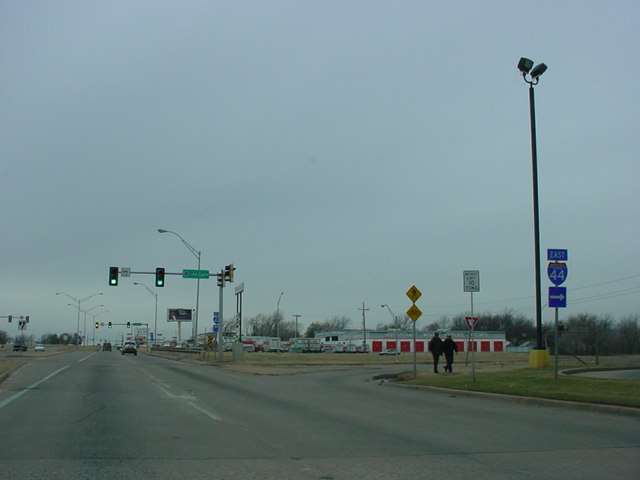
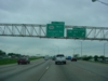
OK
152 West assurance shield between MacArthur Blvd. and
Meridian Ave., about 1 1/2 miles west of Interstate 44. (Photo
taken 4/19/04) |
 |
Mileage sign on
Interstate 44 East, 3/4 mile
south of OK
152 West. (Photo taken 4/19/04) |

 |
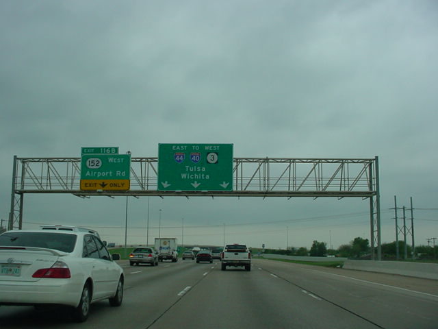
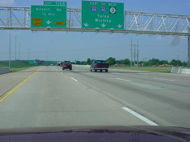
Interstate 44 East approaching Exit 116B - OK 152 West -
1/4 mile. The bottom picture shows the sign in place before
OK 152 was signed along Airport Rd. (Top photo taken
4/19/04, bottom photo taken 8/28/02) |

 |
Interstate 44 East at unmarked Exit 116B - OK 152 West -
Airport Rd. Even with the new sign in place for OK 152, the
sign still lacks an exit tab. (Top photo taken 4/19/04, bottom
photo taken 8/28/02) |
 |
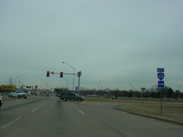
Interstate 44 West at Exit 117B - S.W. 44th St. OK 152
begins in 1/2 mile. (Photo taken 4/19/04) |

 |
Interstate 44 West at Exit 116B - OK 152 West - Airport
Rd.
(Top photo taken 4/19/04, bottom photo taken 3/20/04) |
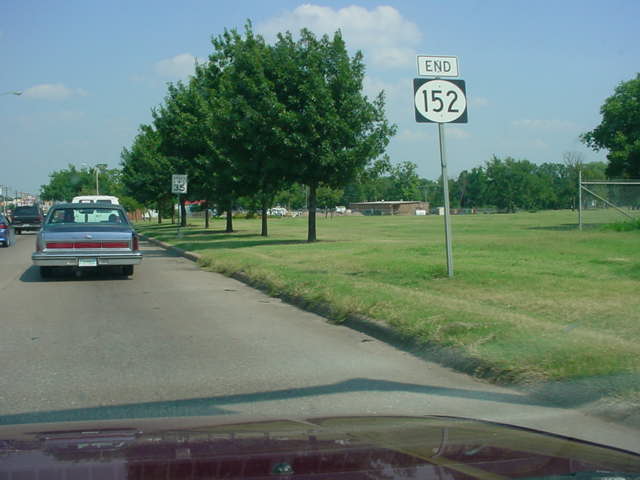
FORMER EASTERN
TERMINUS
S.W. 29th St. @ Interstate 44,
Oklahoma City
|