|

Home
Roadklahoma Links:
Home
Terminus Page
OK 30 Page
Intersecting Highways:
Interstate 40
U.S. 62
OK 9
OK 33
OK 47
OK 152
Latest Updates
Interstate
Highways
U.S. Highways
State Highway
Terminus Gallery
E-mail OKHighways.com
(Spam filter in effect: Use @ in place of #) |
|
OKHighways.com
Terminus Gallery |
| |
|
 |
Highway History:
1953: The highway only went as far north at OK 47 near Reydon.
Highway Review:
OK 30 begins its northerly trek at U.S. 62 in Hollis, five miles east
of the Texas state line. It remains close to Texas its whole distance, as it is
never more than 10 miles east of the state line. Fifteen miles north of U.S. 62,
OK 30 intersects OK 9. The intersection is located in the middle of a valley,
making it a blast when driving on the highway in an ice storm, I am certain!
Twenty-two miles later, OK 30 enters the town of Erick and intersects Interstate
40 at Exit 7. Following the interstate OK 30 continues north towards Sweetwater
and OK 152, which is fourteen miles north of I-40. After a short multiplex with
OK 47, OK 30 heads through the Black Kettle National Grassland, intersects OK
33, and ends a couple miles north of OK 33 in the town of Durham.
Highway Information:
Distance: 84.5 miles
Counties traveled through: Harmon, Beckham, Roger Mills
Highway Intersections: U.S. 62 (Mile 0.0), OK 9 (Mile 15.1), Bus.
I-40 (Mile 37.0), Bus. I-40 (Mile 39.0), Interstate 40 (Mile
39.8), OK 152 (Mile 54.5), OK 47 (Mile 68.6), OK 47 (Mile 71.5),
OK 33 (Mile 82.5)
Highway Duplexes: Bus. I-40 (Miles 37.0-39.0, 2.0 miles, OK 47
(Miles 68.6-71.5, 2.9 miles)
SOUTHERN TERMINUS
U.S. 62, Hollis
 |
"END OK 30" sign at U.S. 62
in Hollis. (Photo taken 10/11/02) |
 |
U.S. 62 West at OK 30
North. (Photo taken 10/11/02) |
 |
U.S. 62 East approaching
OK 30. (Photo taken 10/11/02) |
 |
OK 30 North shield just
north of U.S. 62. (Photo taken 10/11/02) |
OTHER
HIGHWAY PICTURES
 |
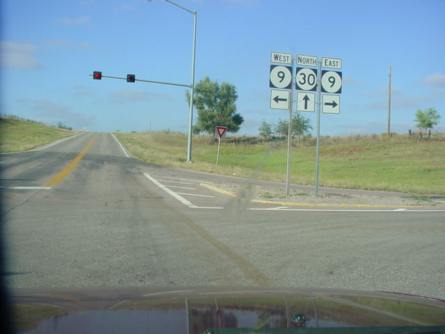
OK 30
North at OK 9. Traffic on OK 30 must stop, but
traffic on
OK 9 doesn't. (Photo taken 10/11/02) |
 |
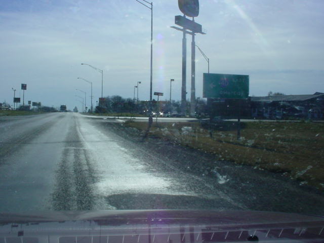
OK 30 South at Interstate 40 East
in Erick. This exit for I-40 has
the final truck stops in Oklahoma for westbound travelers
heading towards Amarillo, Albuquerque, and points beyond.
(Photo taken 11/26/02) |
 |
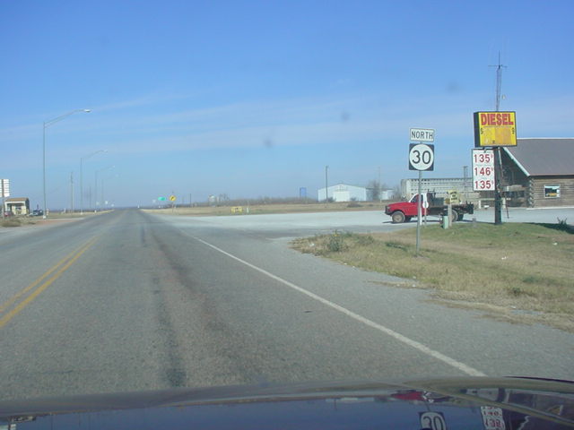
OK 30 North shield just north of Interstate 40. The highway
doesn't see another highway until 15 miles later at OK
152.
(Photo taken 11/26/02) |
 |
OK 30 North at OK 152 north of Sweetwater. OK 152 spans
the western half of the state, from the Texas state line
to
Interstate 44 in Oklahoma City. (Photo taken
11/26/02) |
 |
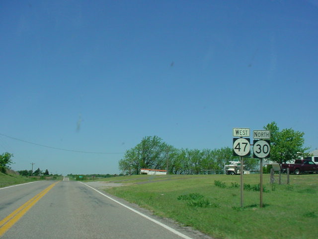
OK
47 West/OK 30 North assurance
shields just south of
Reydon. The two highways have a 3-mile duplex. (Photo
taken 5/6/04) |
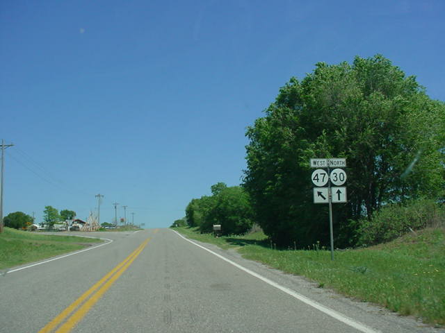
 |
OK
30 North/OK 47 West at OK 47 West in
Reydon.
(Photo taken 5/6/04) |
 |
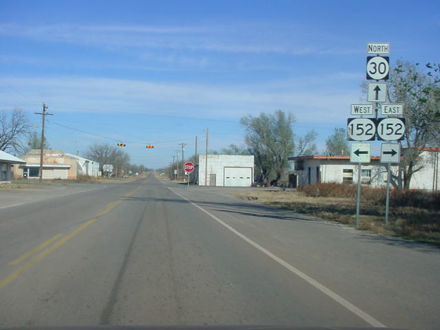
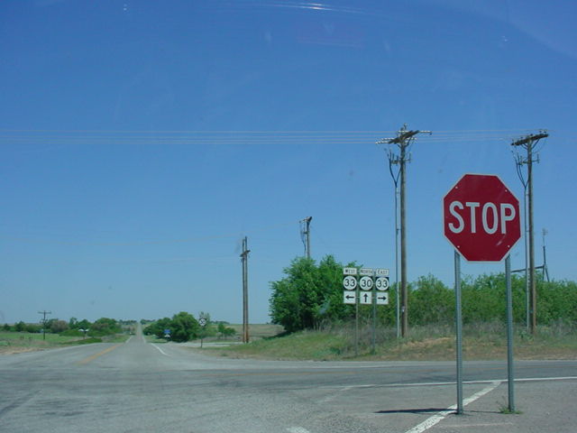
OK
30 North at OK 33. OK 30 ends two
miles ahead at
Durham. (Photo taken 5/6/04) |
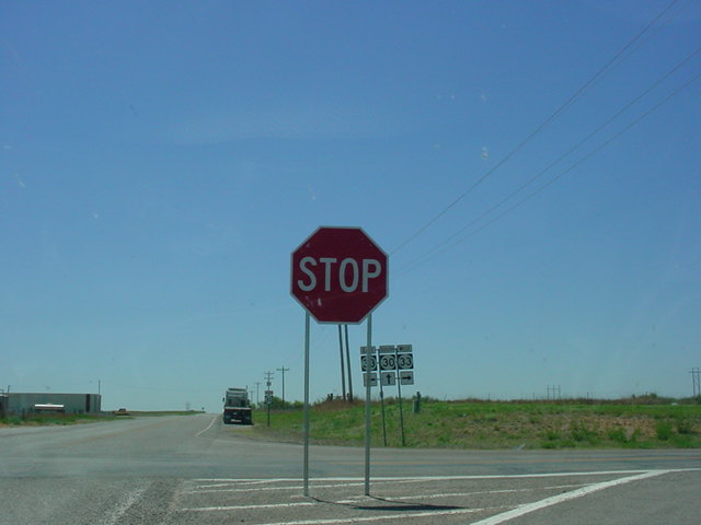
 |
OK
30 South at OK 33. (Photo
taken 5/6/04) |
NORTHERN
TERMINUS
Durham
 |
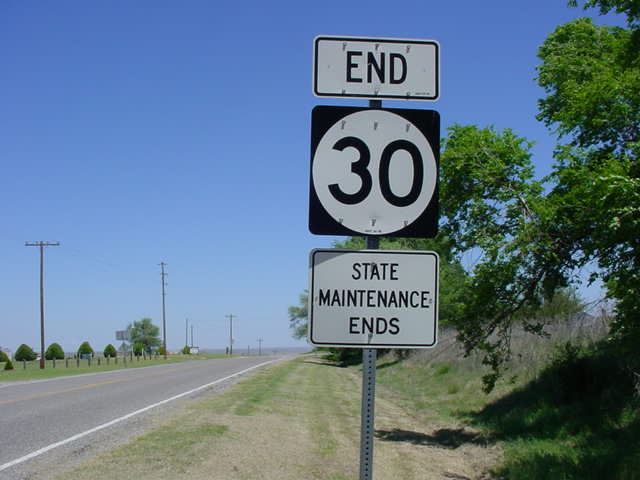
"END OK 30" and "State
Maintenance Ends" signs as OK
30 North concludes after an 85-mile run. (Photo taken
5/6/04) |
 |
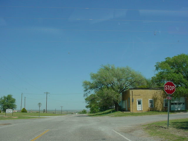
The stop sign at the end of
OK 30 North. Durham is
just off to the right. (Photo taken 5/6/04) |
 |
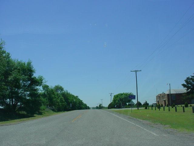
The beginning of
OK 30 South. The first assurance
shield isn't seen until the OK 33 intersection, two miles
ahead. (Photo taken 5/6/04) |
|