|
State Highway E-mail
OKHighways.com
|
PAST PICTURES OF THE WEEK Week of December 23-29, 2004:
U.S. 283 South at OK 5 East. The Texas state line is five miles ahead. Week of December 16-22, 2004:
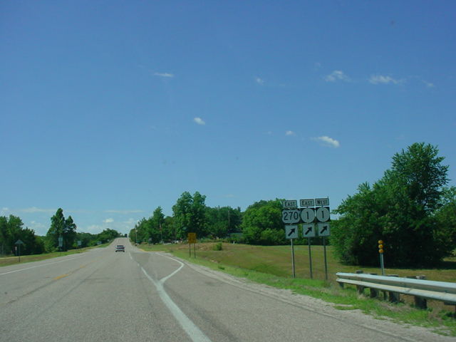
U.S. 270 East/U.S. 281/OK 8 South at U.S. 270 East in Geary. From here, U.S. 270 runs without being multipexed with other highways for the first time since its western terminus in Liberal, Kansas, a distance of over 200 miles. Week of December 9-15, 2004:
U.S. 277/U.S. 281 South at U.S. 70 in Randlett. U.S. 270 and U.S. 281 head west on U.S. 70 for a three-mile multiplex to Interstate 44. Week of December 2-8, 2004:
U.S. 271 South/OK 9 West at OK 112 North - Arkoma. This exit is located just west of the Arkansas State Line. OK 112 will join U.S. 271 and OK 9 for the next two miles. Week of November 25-December 1, 2004:
U.S. 75 South/U.S. 270 East at U.S. 270 East/OK 1 exit near Calvin. This is the southern end of the U.S. 75/U.S. 270 duplex. Week of November 18-24, 2004:
U.S. 266 West at U.S. 69 North near Checotah. A couple of truck stops are located at this diamond interchange. Interstate 40 is located 1/2 mile to the left of this interchange. Week of November 11-17, 2004:
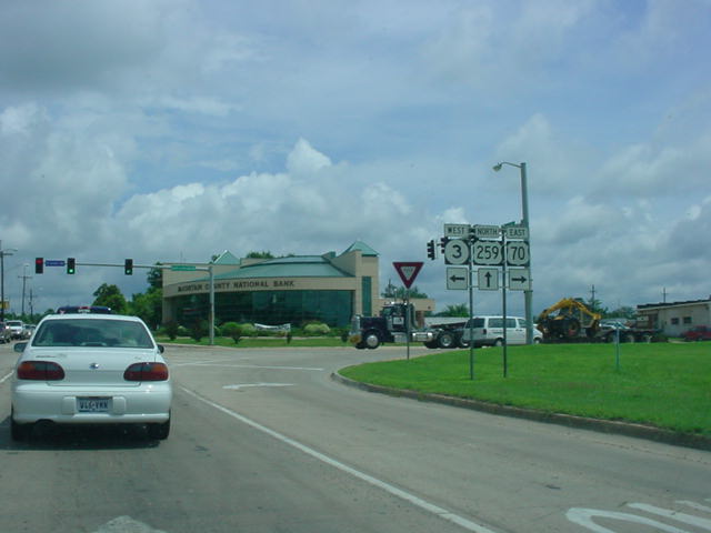
U.S. 70 East/U.S. 259 North/OK 3 West at U.S. 70 East/OK 3 West in Broken Bow. Week of November 4-10, 2004:
U.S. 177 South at Chickasaw Turnpike East near Sulphur. The Chickasaw Turnpike is 2 lanes and connects OK 7 to OK 1. Week of October 28-November 3, 2004:
U.S. 183 South at OK 5 in Frederick. The Tillman County courthouse is on to the right. Week of October 21-27, 2004:
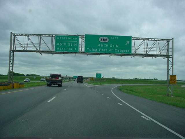
U.S. 169 North at OK 266 East - 46th St. N./Tulsa Port of Catoosa. OK 266 connects U.S. 169 to OK 66 and Interstate 44. Week of October 14-20, 2004:
U.S. 83 North at U.S. 412/OK 3. This intersection, known as Bryan's Corner, has a gas station, which is about the only thing for several miles in this area. Week of October 7-13, 2004:
U.S. 81 South at OK 3 West/OK 33 in Kingfisher. There are two signs that OK 33 West is to the left, but one of them should have an OK 3 shield. U.S. 81 and OK 3 duplex for the next 12 miles. Week of September 30-October 6, 2004:
U.S. 77 North at OK 59 near Wayne. Interstate 35 is three miles to the left (west) of this intersection. Week of September 23-29, 2004:
U.S. 75 North at OK 11 East - Tulsa International Airport. At the time this photo was taken, this was the western end of the Gilcrease Expressway. The freeway has since been extended about 1/2 mile to the west. Week of September 16-22, 2004:
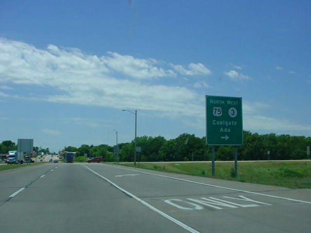
U.S. 69 South at U.S. 75 North/OK 3 West - Coalgate/Ada. U.S. 69, U.S. 75, and OK 3 enter the city of Atoka here. Week of September 9-15, 2004:
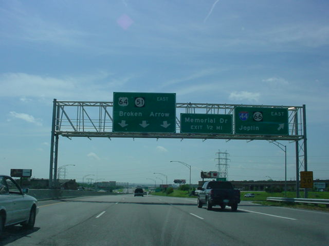
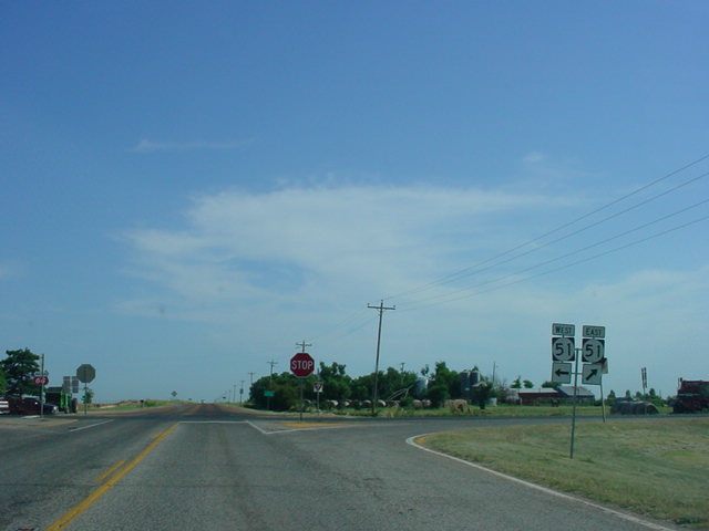
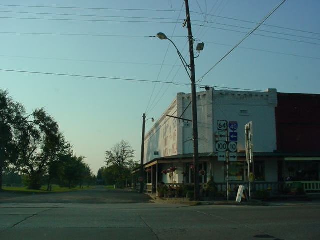
U.S. 64/OK 51 East in Tulsa at Interstate 44/OK 66 East - Joplin. U.S. 64 and OK 51 will split in about two miles. Week of September 2-8, 2004:
U.S. 62 East/OK 10 North at OK 80 North - Ft. Gibson. OK 80 connects this intersection to OK 251A and OK 51 in Hulbert. Week of August 26-September 1, 2004:
U.S. 60 East/U.S. 77 North/U.S. 177 South at Business U.S. 60 - Ponca City, just west of the city. Either fork that one takes here will lead to an oil refinery in about one mile. Week of August 19-25, 2004:
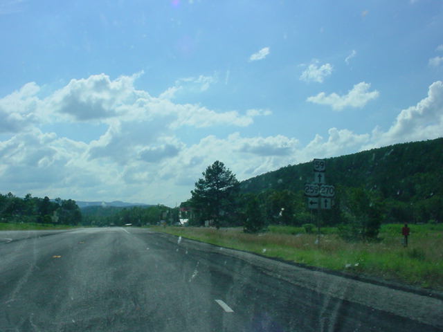
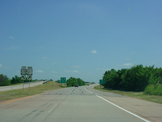
U.S. 59 North/U.S. 270 West at U.S. 259 South. The Winding Stair Mountains provide the mountain scenery in this area. The state of Arkansas is about five miles behind this photo. Week of August 12-18, 2004:
U.S. 56/U.S. 64/U.S. 412 East at U.S. 385 South near Boise City. U.S. 385 joins the other three U.S. highways for about two miles. Week of August 5-11, 2004:
U.S. 54/U.S. 412/OK 3 East/OK 136 South at U.S. 412/OK 3 East/OK 136 South in Guymon. Straight ahead is a truck bypass of downtown Guymon for U.S. 412, OK 3, and OK 136. Week of July 29-August 4, 2004:
Interstate 235 North at unmarked Exit 4B - Interstate 44 East. This interchange marks the northern end of Interstate 235. The freeway continues as the Broadway Extension to Edmond. This tight cloverleaf interchange is slated for reconstruction soon. Week of July 22-28, 2004:
"END Interstate 240" sign assembly as the interstate nears its western end at Interstate 44 in southwest Oklahoma City. This is the only interstate terminus in Oklahoma that has an "END" sign. Interstate 44 crosses over Interstate 240 just ahead. The mainline becomes Interstate 44 East at this interchange. Week of July 15-21, 2004:
Interstate 244 East at Exit 13B - U.S. 169 South. Interstate 244 ends three miles ahead at Interstate 44. Week of July 8-14, 2004:
Interstate 40 West at Exit 153 - Interstate 35 North/U.S. 62 East - Wichita. This interchange was reconstructed in the late 1990s. Two lanes continue straight ahead and merge onto Interstate 35 South in 1/2 mile. Week of July 1-7, 2004:
Interstate 35 South at Exit 112 - Tecumseh Rd., in Norman. This sign was recently put up, but with one omission - the exit arrow. Construction of a median cable barrier along this stretch of Interstate 35 is wrapping up. Week of June 24-30, 2004:
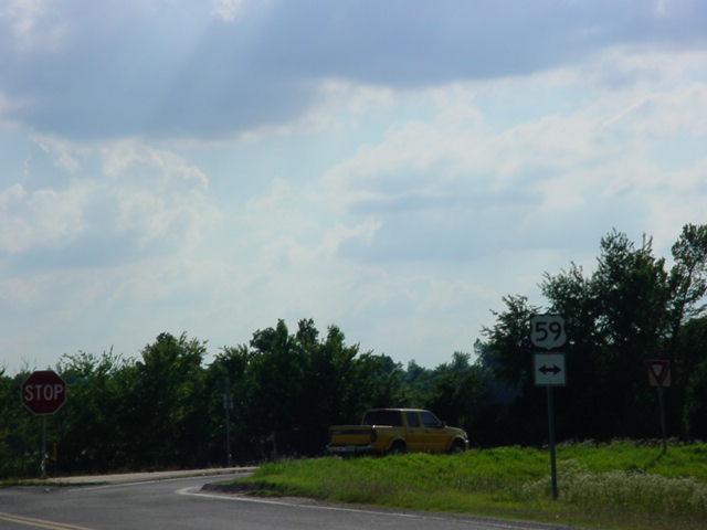
OK 83 West at U.S. 59 near Poteau. With this terminus, I have now photographed every state highway terminus point in Oklahoma! A journey that began on August 24, 2002, ended at 6:10 pm on June 23, 2004, when I got this terminus point. The final terminus trip on June 23 was an OKHighways-record 890 miles long! Week of June 17-23, 2004:
U.S. 69/U.S. 75 South at U.S. 70 - Durant/Lake Texoma. This partial cloverleaf interchange provides access to southern Durant and Lake Texoma. Week of June 10-16, 2004:
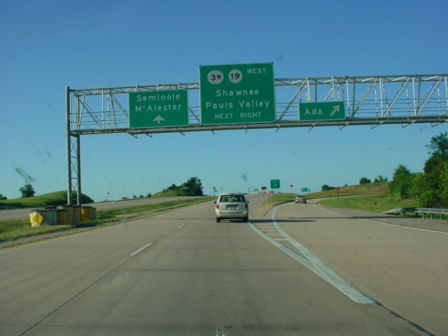
OK 1 East/OK 3 West at the Ada exit. The southeastern split of OK 3 into OK 3W and OK 3E occurs just ahead at the other half of this cloverleaf interchange on the west side of Ada. This interchange also marks the eastern terminus of OK 19. Week of June 3-9, 2004:
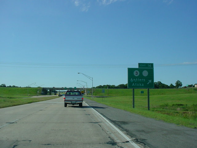
Indian Nation Turnpike North at Exit 16 - OK 3 - Antlers/Atoka. The other shield on the sign was for OK 7, but it no longer goes this far east. Signage at the actual exit, however, still has both OK 3 and OK 7 shields. The Antlers toll plaza is underneath the overpass ahead. Cars pay a $1.50 toll here. Week of May 27-June 2, 2004:
OK 51 East at exits for OK 51 South (should be East) - Coweta, and the Muskogee Turnpike. This is the western end of the turnpike which connects OK 51 in Broken Arrow to Muskogee and Interstate 40 near Webbers Falls. Week of May 20-26, 2004:
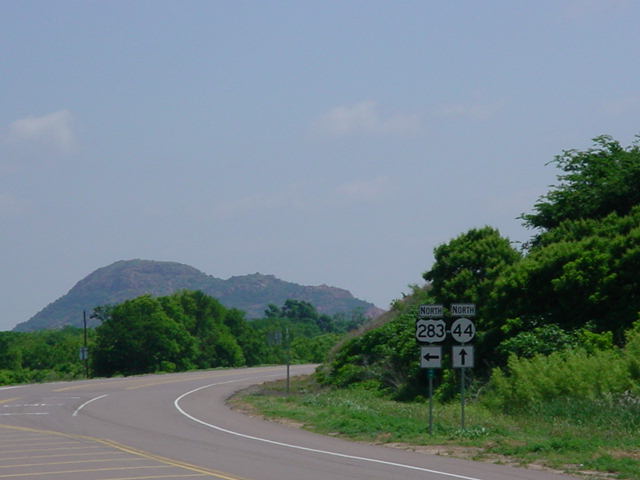
U.S. 283 North at OK 44 North. The Quartz Mountains provide the background scenery. OK 44 connects to OK 33 in Butler at its other end. For more pictures of OK 44, please see the OK 44 page. Week of May 13-19, 2004:
Assurance shields for U.S. 56 West, U.S. 64 West, U.S. 412 West, OK 3 West, and U.S. 287 North just east of Boise City. This multiplex lasts for about a mile. Week of May 6-12, 2004;
OK 102 North at OK 66 near Wellston. This intersection marks the northern terminus of OK 102. Notice the signage for OK 66. Week of April 29-May 5, 2004:
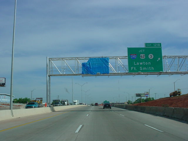
Interstate 35 North at Exit 121B - JCT Interstate 240/U.S. 62/OK 3 - Lawton/Ft. Smith. The signs on Interstate 35 North at Interstate 240 were erected last Sunday, April 25. The left sign is for the S.E. 66th St. exit which has not reopened yet. Week of April 22-28, 2004:
Interstate 44 East at unmarked Exit 116B - OK 152 West - Airport Rd. In the last week, OK 152's eastern terminus was moved two miles to the south from S.W. 29th St. to Airport Rd. OK 152 is now signed along Airport Rd. and S.W. 44th St. between Council Rd. and Interstate 44. Week of April 15-21, 2004:
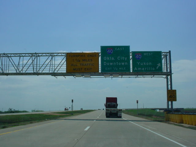
Kilpatrick Turnpike West at Interstate 40 West - Yukon/Amarillo. Week of April 8-14, 2004:
Muskogee Turnpike/OK 165 South at OK 165 West/TO U.S. 64 - Peak Blvd. exit in Muskogee. Interstate 40 is mentioned here, even though it is still over 20 miles to the south. This is the southern end of the Muskogee Turnpike's free section in east Muskogee. Week of April 1-7, 2004:
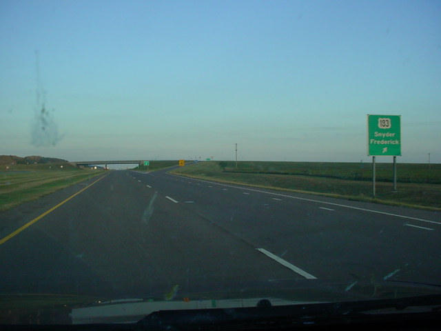
U.S. 62 East at U.S. 183 - Snyder/Frederick. On U.S. 62 between Altus and Lawton, the highway is an expressway with at-grade intersections and two interchanges; one at U.S. 183 and the other at OK 115 near Cache. Week of March 25-31, 2004:
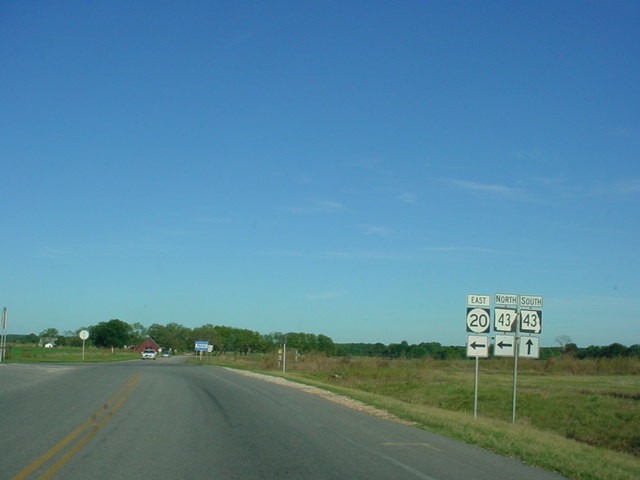
OK 20 East at AR 43 at the Oklahoma-Arkansas State Line. AR 43 South is signed as MO 43 South here, but MO 43 does not begin for another five miles to the north. For those five miles, OK 20 and AR 43 duplex. Another oddity about this T-intersection is that traffic on both directions of AR 43 must stop, but OK 20 East does not stop. Week of March 18-24, 2004:
OK 74 North at OK 51 near Marshall. OK 74F is just a few miles ahead if you go straight on OK 74 or turn left onto OK 51 West. Week of March 11-17, 2004:
U.S. 64 West/OK 10 North at OK 100 in Gore. U.S. 64 continues to the left, and OK 10 continues to the right. Interstate 40 is mentioned on this sign assembly because it is just a few miles to the south of this intersection. Week of March 4-10, 2004:
U.S. 412 West at U.S. 69 North - Chouteau exit. The cloverleaf interchange once marked the eastern end of the expressway part of U.S. 412 before the Cherokee Turnpike was built five miles to the east. Week of February 26-March 3, 2004:
Interstate 35 North approaching Exit 126 - Interstate 40 West - 1 mile, and Interstate 235 North - 1 mile. Interstate 35 through traffic must merge into the right lane ahead to stay on Interstate 35. The right lane at this particular spot becomes Interstate 235. Just ahead, however, a right lane is added from the on-ramp from S.E. 15th St. (the overpass in the picture), and that is the lane that is used for Interstate 35 North through traffic. Week of February 19-25, 2004:
OK 152 East at Council Rd. in rural southwest Oklahoma City. OK 152 has recently been realigned between County Line Rd. and Council Rd. Eventually, OK 152 will go over Council Rd. and will meet the current OK 152 around MacArthur Blvd., but for now, OK 152 exits here and goes south on Council for a mile before meeting up with its current alignment in Wheatland. For more information and pictures on the widening, please see the OK 152 Realignment page. Week of February 12-18, 2004:
U.S. 177 South/U.S. 270 East/OK 3W East at U.S. 270 East in Tecumseh. U.S. 270 merges onto OK 9 just ahead. The Big Green Signs (BGSs) in the distance say (left) "U.S. 177 South/OK 3W East - Sulphur/Ada - Left Lane" and (right) "OK 9 - Tecumseh - Right Lane." Week of February 5-11, 2004:
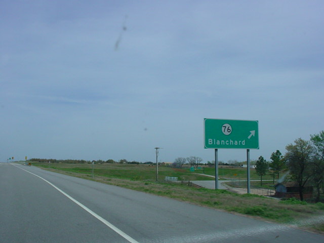
H.E. Bailey Turnpike Spur East at OK 76 - Blanchard. The spur connects Interstate 44 and OK 4 to OK 9 and Interstate 35. The turnpike ends at U.S. 62/U.S. 277/OK 9, but continues east from there as OK 9, which is being widened to four lanes between the end of the spur and Interstate 35. Week of January 29-February 4, 2004:
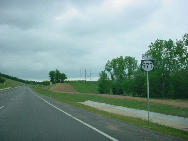
OK 97T North assurance shield just north of U.S. 64/U.S. 412. OK 97T was completed in January 2003, and was decommissioned by the Oklahoma Department of Transportation just one year later. Week of January 22-28, 2004:
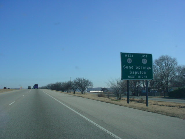
U.S. 64/U.S. 412 East at the OK 51 West/JCT OK 97 exit in Sand Springs. Most signage along this stretch of the Keystone Expressway is button copy, and some of it is barely legible, like these button copy shields here. Week of January 15-21, 2004:
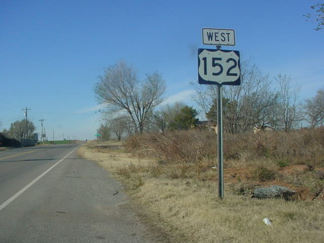
This week's POTW shows one of several error U.S. 152 shields in western Oklahoma. This particular shield is on OK 152 West just west of OK 30 in Sweetwater. There are also U.S. 152 shields near the intersections at U.S. 283, OK 6, U.S. 281, OK 42, and OK 34. Week of January 8-14, 2004:
From the same location as last week's picture of the week, this picture, taken after the construction was completed, shows the new signage at Interstate 44 East's Exit 231. The new signs have added a "TO" banner, even though the exit is still for U.S. 64 and OK 51. U.S. 169 has also been added, since there is no longer direct access from Interstate 44 East to U.S. 169 South. Week of January 1-7, 2004:
The first ever OKHighways.com picture of the week is of Interstate 44 East at Exit 231 - U.S. 64/OK 51 - Muskogee/Broken Arrow. These relic button copy signs have since been replaced. Much like the interstate was at the time of this photograph, OKHighways.com is still under construction.
|