|

Home
Roadklahoma Links:
Home
Terminus Page
OK 28 Page
Intersecting Highways:
Interstate 44
U.S. 60
U.S. 69
U.S. 169
OK 20
OK 28A
OK 66
OK 82 (N)
OK 82A
Latest Updates
Interstate
Highways
U.S. Highways
State Highway
Terminus Gallery
E-mail OKHighways.com
(Spam filter in effect: Use @ in place of #) |
|
OKHighways.com
Terminus Gallery |
| |
|
 |
Highway Review:
OK 28 runs from U.S. 169 near the town of Delaware to OK 20 west
of Jay. It is an east-west highway, yet a good part of it runs
north-south. After beginning at U.S. 169, OK 28 runs due east for
about five miles, then turns to the south for the next 27 miles.
During its north-south stretch, OK 28 intersects U.S. 60, OK 66,
and OK 28A, and has a short wrong-way duplex with OK 66. At OK
28A, OK 28 heads to the east once again, where it remains for all
but the last couple miles of its almost 70 miles total. Three
miles after heading east at OK 28A, OK 28 has an on-ramp to
Interstate 44 West. At the interchange, there is only an off-ramp
from Interstate 44 East to OK 28 and an on-ramp from OK 28 to
Interstate 44 West. Six miles later, OK 28 intersects U.S. 69 in
the town of Adair, and OK 28 continues on towards the Grand Lake
area. During its short duplex with OK 82, the highways skirt the
southern edge of Grand Lake. After leaving OK 82 behind, OK 28
winds its way to OK 20, where the highway finds its eastern end.
Highway Information:
Distance: 68.8 miles
Counties traveled through: Nowata, Rogers, Mayes, Delaware
Highway intersections: U.S. 169 (Mile 0.0), U.S. 60 (Mile 11.4),
OK 66 (Mile 26.0), OK 66 (Mile 26.7), OK 28A (Mile 32.8),
Interstate 44 (Mile 35.7), U.S. 69 (Mile 41.9), OK 82 (Mile
54.9), OK 82 (Mile 55.7), OK 20 (Mile 68.8)
Highway duplexes: OK 66 (Miles 26.0-26.7, 0.7 miles), OK 82
(Miles 54.9-55.7, 0.8 miles)
WESTERN
TERMINUS
U.S. 169, south
of Delaware
 |
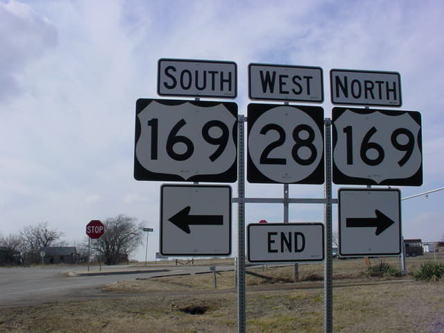
"West OK 28
END" signage at U.S. 169. The
town of
Delaware is located just to the north and west of this
intersection. (Photo taken 2/14/03) |
 |
U.S. 169 North at
OK 28 East. U.S. 169 will enter the state
of Kansas in 16 miles. (Photo taken 2/14/03) |
 |
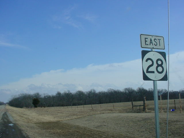
First OK 28 East
assurance shield just east of U.S. 169.
The highway will end in 68 miles at OK 20. (Photo taken
2/14/03) |
OTHER
HIGHWAY PICTURES
 |
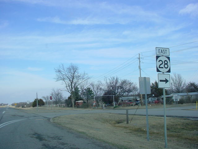
OK 28 East at U.S. 60. OK 28 is actually heading south at
this intersection. Vinita is a 22-mile drive away for
those
heading east from here on U.S. 60. (Photo taken
2/14/03) |
 |
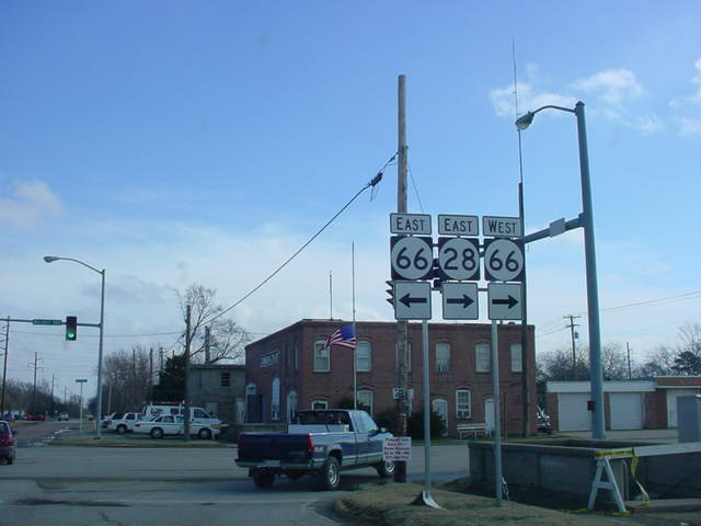
OK 28 East at OK 66 in Chelsea. OK 28 East heads to
the right with OK 66 West at this stoplight, creating a
wrong-way duplex situation. (Photo taken 2/14/03) |
 |
OK 66 East/OK 28
West at OK 28 West in Chelsea.
(Photo taken 4/25/03) |
 |
OK 66 West/OK 28
East assurance shields just south of
the intersection pictured above. (Photo taken
2/14/03) |
 |
Less than a mile
after it began, OK 28 East heads to the
left and splits from OK 66 West. (Photo taken
2/14/03) |
 |
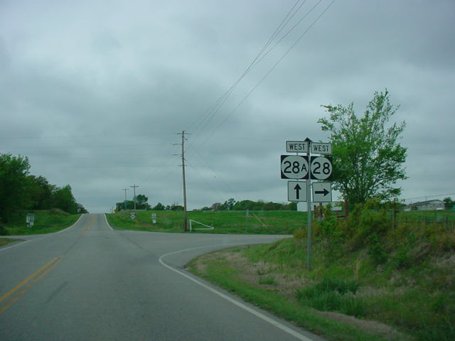
OK 28 West at OK 28A West. OK 28A provides easier
access to OK 66 and points west. (Photo taken
4/25/03) |
 |
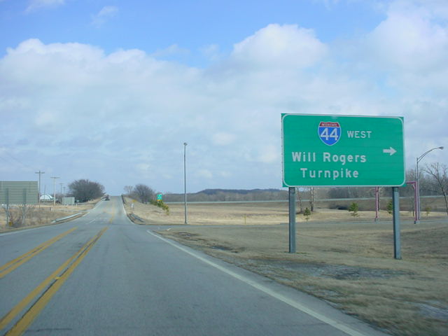
OK 28 East at
Interstate 44 West. The interchange here
is partial-access, with access only allowed from OK 28 to
Interstate 44 West and from Interstate 44 East to OK 28.
(Photo taken 2/14/03) |
 |
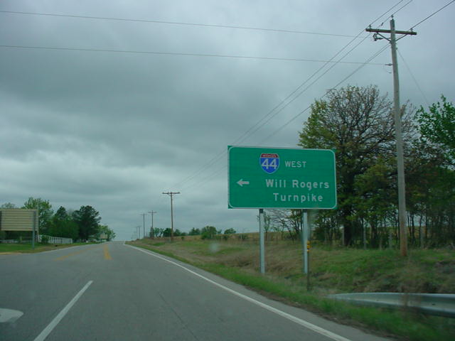
OK 28 West at
Interstate 44 West. OK 28A begins three
miles ahead. (Photo taken 4/25/03) |
 |
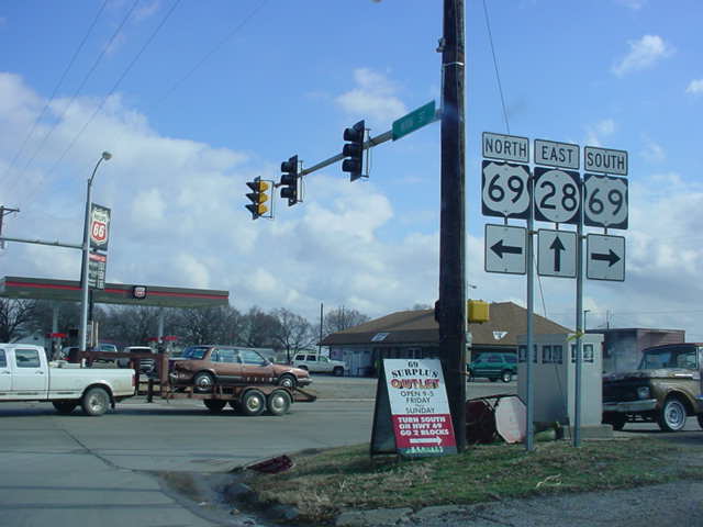
OK 28 East at U.S.
69 in Adair. Grand Lake is about 13
miles straight ahead. (Photo taken 2/14/03) |
 |
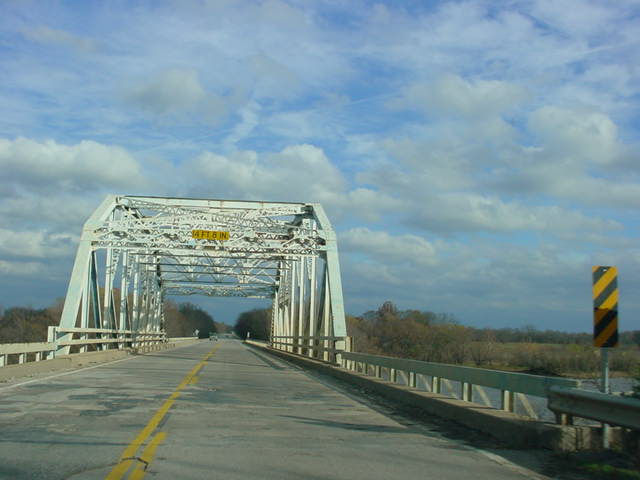
OK 28
East as it prepares to cross a bridge near
Langley. (Photo taken 11/26/04) |
 |
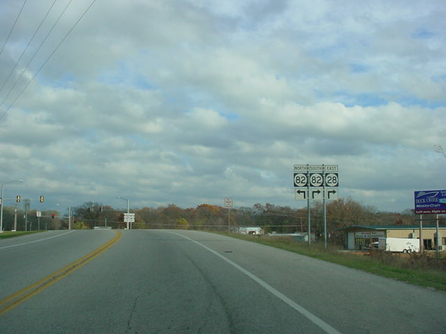
OK 28
East approaching OK 82 in Langley. (Photo
taken 11/26/04) |
 |
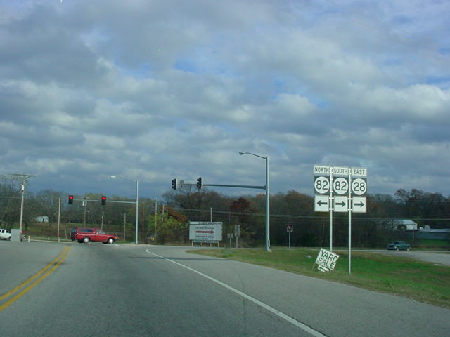
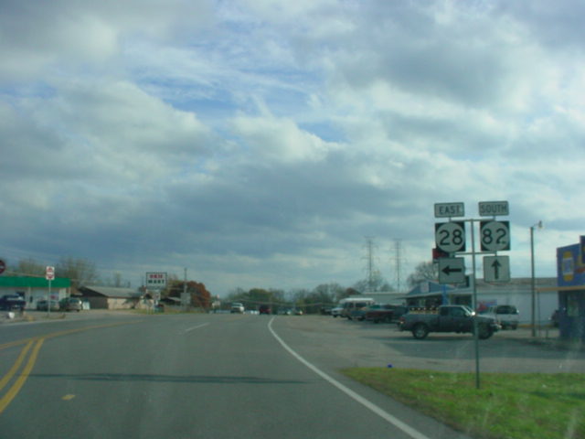
OK 28
East at OK 82. The two highways duplex for the
next mile southward. (Photo taken 11/26/04) |
 |
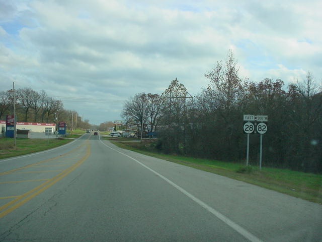
OK 28
East/OK 82 South assurance shields just south
of the northern end of the duplex. (Photo taken 11/26/04) |
 |
OK 28
East/OK 82 South at OK 28 East in Langley.
(Photo taken 11/26/04) |
EASTERN
TERMINUS
OK 20, west of
Jay
 |
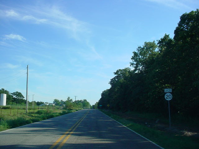
OK 28 East
approaching OK
20. The highway is heading
south at this point. (Photo taken 9/4/03) |
 |
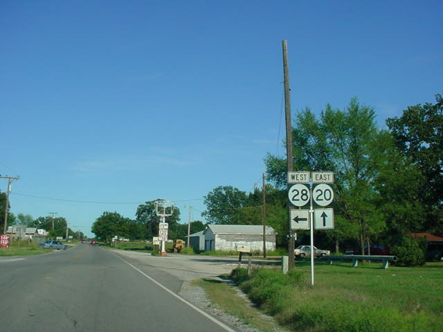
OK 28 East at OK
20. There is no directional signage
for OK 20 around, nor is there an "END" sign to
be
found. (Photo taken 9/4/03) |
 |
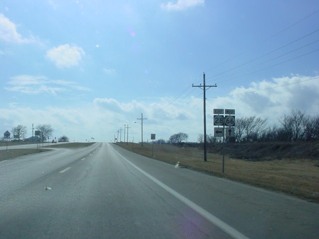
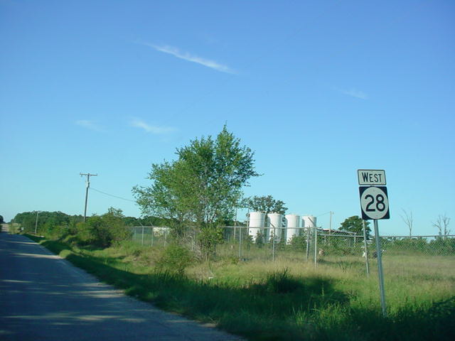
OK 28 West
reassurance shield just north of OK 20.
The highway will intersect OK 82 in 13 miles. (Photo
taken 9/4/03) |
 |
OK 20 East at OK 28
West near Jay. The gas station
on the NE corner had the cheapest gas I saw this far from
a city this day, with prices at $1.49/gallon. (Photo
taken
9/4/03) |
|