|

Home
Roadklahoma Links:
Home
Terminus Page
OK 259A Page
Intersecting Highways:
U.S. 259
Latest Updates
Interstate
Highways
U.S. Highways
State Highway
Terminus Gallery
E-mail OKHighways.com
(Spam filter in effect: Use @ in place of #) |
|
OKHighways.com
Terminus Gallery |
| |
|
 |
Highway Review:
OK 259A connects to U.S. 259 on both ends and provides access to the
Beavers Bend State Park in McCurtain County. The highway forms 3/4 of a circle
and is signed east-west from both termini.
Highway Information:
Distance: 9.3 miles
Counties traveled through: McCurtain
Highway intersections: U.S. 259 (Mile 0.0), U.S. 259 (Mile 9.3)
Highway duplexes: None
Traffic Counts:
530 - OK 259A @ U.S. 259 (both intersections)
SOUTHERN TERMINUS
U.S. 259, north of Broken Bow
 |
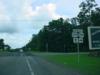
"END OK 259A" sign as
OK 259A
West prepares to end at U.S. 259.
(Photo taken 6/23/04) |
 |
OK
259A West at U.S. 259.
Broken Bow is seven miles to
the left. (Photo taken 6/23/04) |
 |
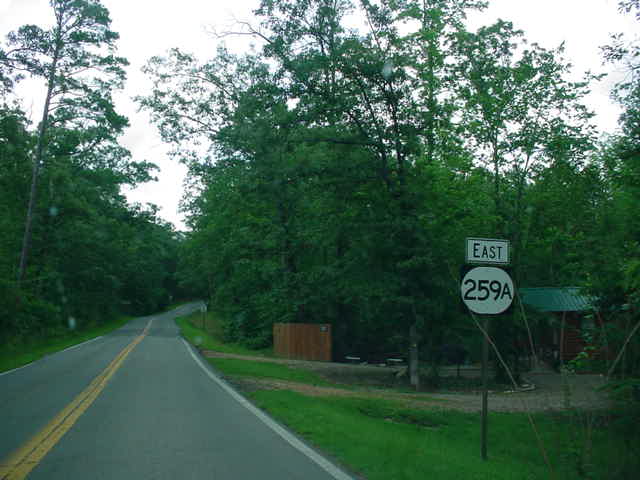
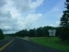
OK
259A East assurance shield
just east of U.S. 259. The highway
will enter Beavers Bend State
Park in about four miles. (Photo
taken 6/23/04) |
 |
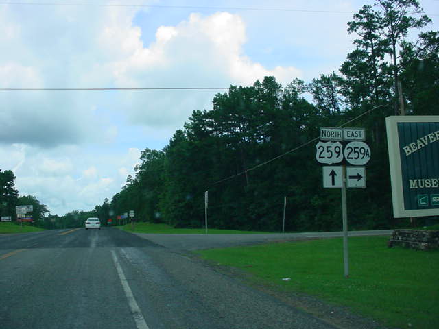
U.S.
259 North at OK 259A East.
The other terminus of OK 259A
is two miles ahead. (Photo taken
6/23/04) |
NORTHERN
TERMINUS
U.S. 259, north of Broken Bow
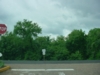 |
OK
259A West at U.S. 259.
There is no "END" sign at
this terminus. (Photo taken
6/23/04) |
 |
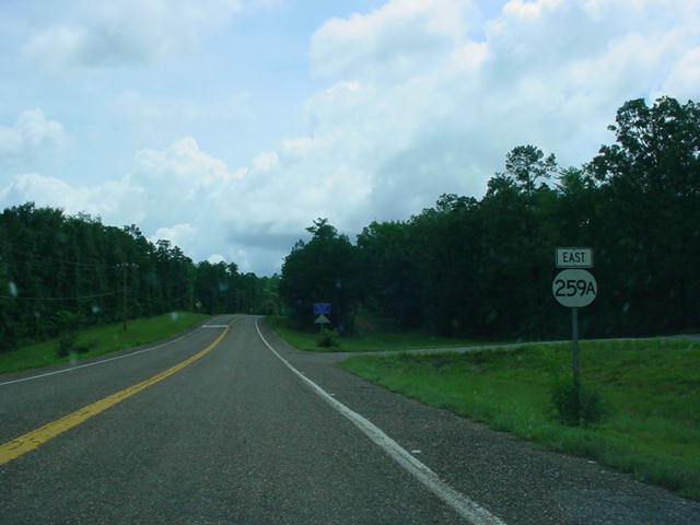
OK
259A East assurance
shield just east of U.S. 259.
(Photo taken 6/23/04) |
 |
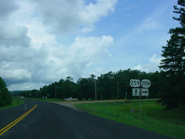
U.S.
259 North at OK 259A
East. (Photo taken 6/23/04) |
|